

The Vancouver skyline.
After growing up and living the Pacific Northwest for many years I finally had an opportunity to visit Vancouver, British Columbia last weekend. Along with Seattle and Portland, it is an important hub of the Cascadia region and I was intrigued by what I’ve heard about it. And, quite frankly, I had a stunning experience. Though I was only in the city for about 30 hours, I could see that Vancouver is much more progressive in its city planning and design, resulting in an urban environment that is highly sustainable and delightfully livable.
The Vancouver area was settled by Europeans in the mid-1800s for mining, timber, and fishing. The city was selected for the terminus of the Canadian Pacific Railway, and soon after incorporated in 1886. Export shipping and manufacturing grew through the early 1900s and World War Two, and now Vancouver is home to Canada’s largest port. Today, other major industries include film and television, biotechnology, and software development. Surrounded by mountains and waterways, the city also draws many tourists, including those passing through on cruise ships. In the late 1990s the city had an influx of foreign investment, primarily from Hong Kong, that radically transformed the skyline with multitudes of residential towers. A light rail system was built in time for the 1986 World Exposition and Vancouver hosted the 2010 Winter Olympics, significantly boosting the local economy.
After learning this I still didn’t know what to expect from my visit. Vancouver was discussed several times in my classes the previous academic year, but mostly from an urban design perspective. The city is noted among planners for being one of the few, if not the only, North American city with no major freeways running through it. Zoning strictly regulates the form of skyscrapers, ensuring adequate light, air, and views for neighboring buildings and the street level. The surrounding mountains and variety of parks contribute to a reputation for health and active living.
Living car-free, rather than fly I choose to try the Amtrak Cascades passenger service that runs twice daily between Seattle and Vancouver. I found a decent downtown hotel halfway between the rail station and the downtown core, and departed on a Friday morning. I recently had a reason to ride on Sound Transit’s commuter rail and this was my first Amtrak trip since childhood; on the way north, I became convinced that if I have a choice, passenger rail is the way to travel. Comfortable seating, picturesque views, freedom to move around, and free wi-fi and power beat out the other options. Connecting U.S. cities with high-speed passenger rail is a struggling but worthwhile effort.

Welcome to…Vancouver?
Upon arriving and going through customs I found that the city right outside the station is bustling. I didn’t realize that the light rail stop down the block could have brought me near to my hotel, so I started the mile long walk with camera in hand. I got a little lost on the way and found myself underneath the Georgia Street viaduct, which wraps around the BC Place Stadium. The concrete solitude was unexpected, but there were actually other people walking down there and I soon found my way.
During the entire trip I felt safe while on foot and found drivers are courteous and alert. To date, Vancouver has only had one pedestrian fatality this year, which is the lowest since record keeping began in 1934. Though the police credit this to their enforcement and educational activities, is is clear that the city’s engineers and planners deserve just as much praise.

Vancouver has a comprehensive bicycle network. The street signs even alert drivers where bicyclists may be crossing.
The streets aren’t paved with gold, but they might as well be. Cycle tracks are built into every other major downtown street, usually with heavy planter boxes as buffers; this was was humorous when I compared it to the hoopla around the opening of Seattle’s first downtown cycle track a few days before my visit. The urban character is maintained with continuous rows of retail along the wide sidewalks. Transit stops have nicely designed shelters and street trees are abundant and help maintain a human sense of scale.
I also noticed that the city’s streets are immaculate. I saw very little, if any, litter, probably thanks to the abundance of waste bins and Canadians’ notable respect for their environment. Even the alleyways (called “lanes”) were clean and comfortable to walk in. I found nary a pothole or a cracked sidewalk, illustrating abundant maintenance funding or that infrastructure is built right in the first place. Granted, I observed most of this in the city center, but the result is that Vancouver has a high share of people who commute by foot, bike, and transit.

Busy Granville Street.
After checking in I hit the streets. Without mobile service I had to rely on my intuition and a tourism map I’d printed at home. I found Granville Street, a sort of transit mall lined with shops and restaurants, and headed towards the northern waterfront. Along the way I stopped at a deli for lunch. I observed the street life and was amused to watch a florist, his stand on the sidewalk outside, obsessively tend to his displays. I recalled that Seattle is one of the few major cities I know of that does not seem to support these sort of pop-up businesses and vendors on its streets.

The east promenade of the Vancouver Convention Centre.
Next to the impressive cruise ship terminal I found the Vancouver Convention Centre, a massive building that supports a six acre green roof. As the designers probably intended, I was drawn down the building’s wide promenade that is lined with stores and includes a two-way bike path. There is also, appropriately, a sculpture of a giant rain drop at the bottom. Beside the building is one of the busiest seaplane ports in the world, with both sightseeing and commercial flights to destinations around the region. I found myself following the promenade and later learned that it is the starting point for the Vancouver seawall, a 22 kilometer (13.6 miles) walking and biking path that wraps around the shoreline of the downtown and neighboring areas.

Stanley Park has over 8 million visitors per year. The Lions Gate bridge, at right, connects to the northern suburbs.
I followed this path out of downtown past glimmering condo towers and forests of sailboat masts and into Stanley Park. At nearly 1,000 acres, the park transported me out of the urban environment like no other park I’ve been in, though Seattle’s Discovery Park and Ravenna Park come close. Unlike many urban parks, it wasn’t designed by a landscape architect and is mostly untouched wilderness with hundreds of thousands of trees. The seawall lines the park perimeter, but I found some shortcuts so I wouldn’t spend my entire day there. The park seems to be well programmed, containing attractions like an aquarium, a miniature railroad, and food stands.

English Bay Beach on the northwestern edge of downtown.
I emerged in the upper class West End neighborhood, which despite its high density had relatively little traffic. I soon stumbled upon English Bay Park, a sandy stretch of beach lined with with shops and restaurants and had hundreds of people lounging or passing through by foot and bike. The natural beauty and dynamism of this place, combined with the perfect weather, made me realize I would live in Vancouver if given the chance. But it would be financially difficult. Vancouver has been listed as one of the least affordable cities in the world and tenants are often fighting against high rents.
As I walked down the coast I reflected on the almost overwhelming abundance of public space in Vancouver. Wide sidewalks and frequent plazas and pocket parks provide lots of breathing room for the urban dweller. Appropriately placed sculptures, murals, and other art contribute to a sense of culture and whimsy. Access to the entirety of the waterfront gives the impression that Vancouver is designed for all of its citizens. American waterfronts are often in private ownership, complicating recently renewed efforts to increase access to shorelines and prepare infrastructure for sea level rise.

Granville Island has great examples of shared streets, but automobiles are still dominant.
Getting to Granville Island took only a three minute miniature-ferry ride that was crewed by a single person; Vancouver has several such private companies that carry tourists and commuters across its waterways. The island, actually a peninsula, has transformed from a gritty industrial hub and into a classic tourist trap. A variety of arts and crafts shops, a public market, and several fine dining restaurants draw many visitors. A concrete mixing plant remains in the heart of the district with brightly colored silos. I had dinner at a brewery with a waterfront patio that offered an excellent view of the downtown skyline.
At the end of the night I checked out Gastown, the founding neighborhood of Vancouver. Today it’s a popular nightlife corridor centered on brick-paved Water Street. It’s historical character reminded me of the Baltimore waterfront or King Street in Alexandria, Virgina. One bartender instantly pegged me as an American and offered a drink on house, welcoming me to his fine city. Chatting with some locals was a great end to the first day.
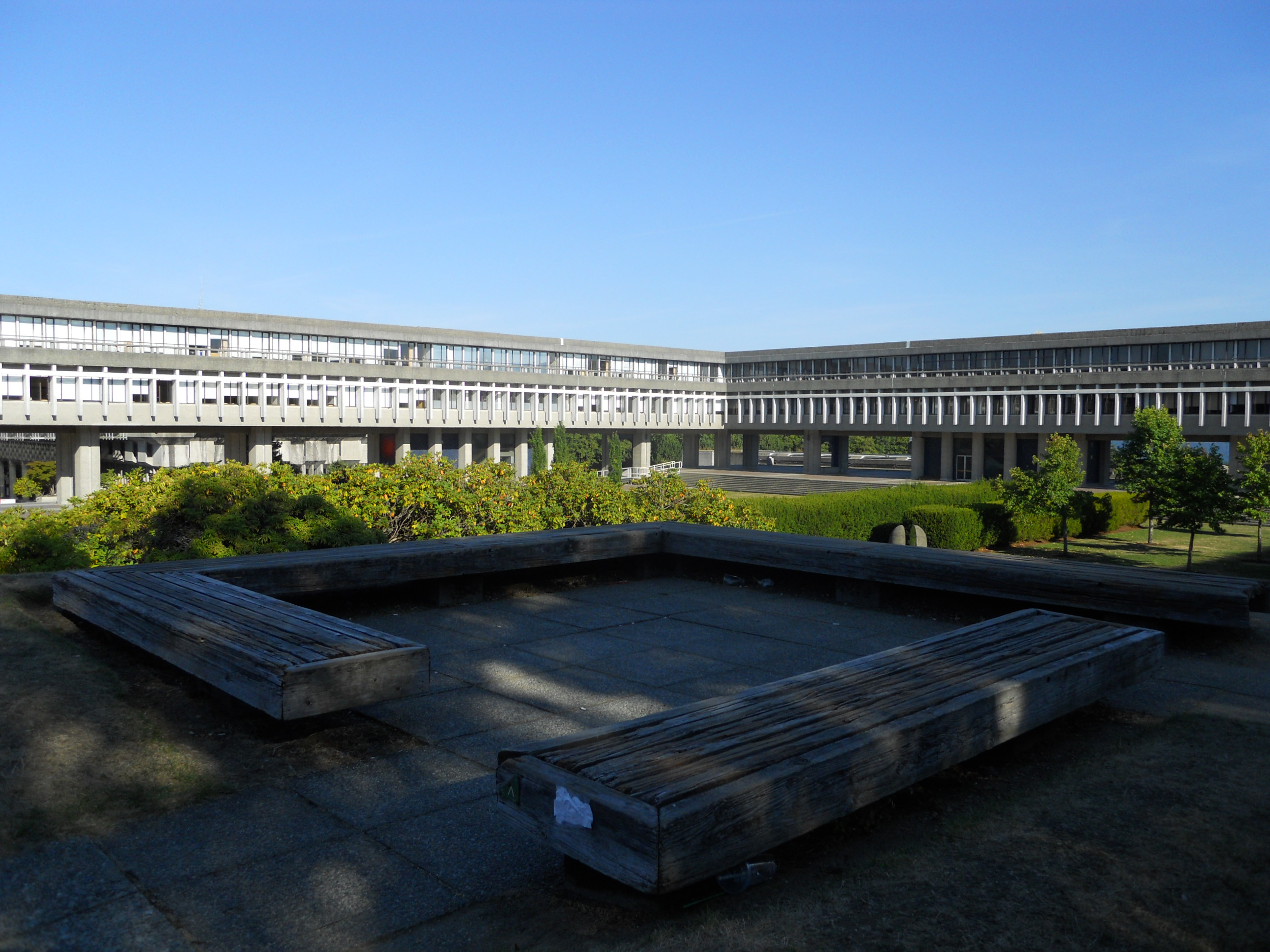
The Academic Quadrangle at the Burnaby campus of Simon Fraser University.
Early the next morning I rented a Zipcar, coincidentally across the street from my hotel, to drive out to Simon Fraser University, a public school in the eastern suburb of Burnaby that is often featured in science-fiction movies and television. The campus is at the top of a forested mountain, giving it an air of prestige and isolation. Its architecture is uniformly brutalist-modernism that effortlessly mixes indoor and outdoor space while embracing the surrounding landscape. This design style contrasted heavily with the University of British Columbia, which I visited afterwards by bus on the western side of Vancouver. That campus is more traditional, composed as a grid of pathways and buildings with a variety of architecture styles, but is also much larger and actually almost unwalkable. Both campuses were surprisingly unpopulated on my visit, which I thought may be related to a long teacher’s strike.
On my trip to both campuses I noticed that the outlying neighborhoods and neighboring towns don’t devolve into suburban sprawl. Rather, the urban character is maintained for miles and miles simply with multi-story and mixed-use buildings that have zero setback from the street. This doesn’t hold true for the entire Vancouver metro area, of course, but it’s interesting that zoning has been employed in such a way. On my driving trip I noted that the streets have a consistent layout that increases safety for all users, even if the standard layout is six lanes on the arterials. I never did figure out what a flashing green traffic light means besides “go”.
Among other observations, the transit systems were easy to ride with previous knowledge. The bus stops I used did not have printed schedules or maps, unfortunately, but when paying with cash I received an automatically-dispensed ticket that worked magnetically for 90 minutes, eliminating any chance of free rides. The light rail stations are well designed, but instead of displaying the entire system map there were maps based on your current location, adding to some confusion. I ended up purchasing single-trip tickets for all of my transit dies because it was unclear if the day-pass worked for 24 hours or only for the current day.

The Vancouver seawall.
Vancouver’s meticulous civic design and planning is a model for how other cities, especially in the Pacific Northwest, can enhance quality of life and ensure a strong economy for their citizens. Planners and city leaders should look to Vancouver for successful examples of complete streets, public space networks, parks, high-density mixed-use zoning, transit systems, architectural design standards, and more. I’m appreciative that I could visit this world class city and add it to my collection of inspirations for great urban planning.

Pingback: The Metro Neighborhood: A Renewed Vision for Downtown Seattle | The Northwest Urbanist
Pingback: Seattle Bike Activists Launch Major Infrastructure Campaign | The Northwest Urbanist
Pingback: Seattle Bike Activists Launch Major Infrastructure Campaign | The Urbanist
Pingback: On Growth, Transit, and Bikes in Vancouver B.C. | The Northwest Urbanist
Pingback: Post 100 | The Northwest Urbanist